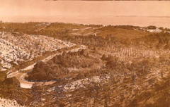
Kent Ridge has always been an area of great academic interest and experience and in NUS has been the focus of nature and heritage walks, academic research, student learning as well as walks and runs for health and fitness. Most recently, a briskwalk series was introduced to promote fitness of staff welded behind their desks, and for us to relax with one another on Friday evenings.
In January 2007, the map for the Kent Ridge Heritage “Walk and Run” Trail was finalised after months of work with contributions from various stakeholders of Kent Ridge in and out of NUS. The Kent Ridge Heritage Trail is mapped by signboards at various locations from Clementi Road to Bukit Chandu, and we hope this 10-year old map will encourage you to explore the area! Click to download the pdf.

To find out more about the area, visit the Pasir Panjang/Kent Ridge Heritage webpage.


will there be a walk on 28/4? met at YIH @ 1730hrs? can we peel off after 4km ? we knock off at 1730hrs wo may take some time to reach YIH